
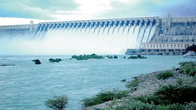
Kaddam project was taken up in the year 1949, across KaddamRiver, tributary of Godavari, in Adilabad District, as an integral part of Godavari Valley Scheme contemplated by the erstwhile Government of Hyderabad to irrigate lands on the North flank of Godavari, and completed in 1958. But, due to the unprecedented floods on 31-08-1958 the dam was breached.
Kaddam project was taken up in the year 1949, across KaddamRiver, tributary of Godavari, in Adilabad District, as an integral part of Godavari Valley Scheme contemplated by the erstwhile Government of Hyderabad to irrigate lands on the North flank of Godavari, and completed in 1958. But, due to the unprecedented floods on 31-08-1958 the dam was breached.
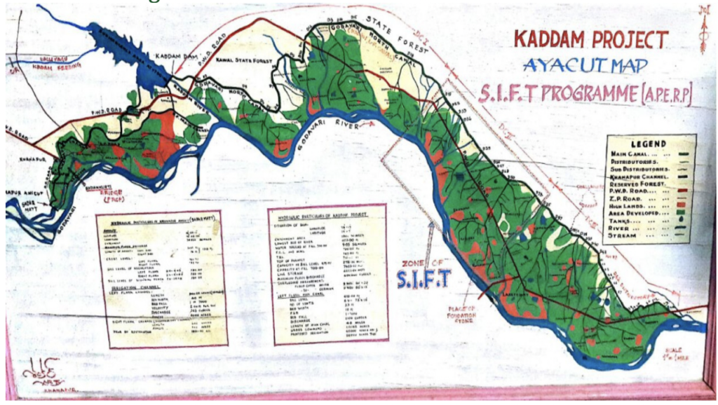
The reservoir was constructed across Kaddam Riveroriginates from the hills of Dedra reserved Forest in Adilabad District and runs South East Directionfor a length of 86Kms and joins river Goadvari at Dasturabad in Kaddam Mandal at its 80th km and it is situated in Kaddam Mandal of Adilabad District. After traversing a distance of 6.5km from the Dam the river joins Godavari. It is 48km East of Nirmal Town on Basar – Mancherial Road.
Source RIVER : KADDAM, WHICH IS A TRIBUTARY TO GODAVARI RIVER Sub Basin G10 Catchment area 2590 Sq.Km (1000sq.Miles) Gross storage 7.603 TMC Catchment Shape Fan shaped Falls steeply 1in 350 highest point in the catchment +457 M ( 1500ft) lowest above mean sea level +183 M (600ft) Flood Discharge (observed) 14696 Cumces (5,19,000 cusecs) Designed Discharge 10800m3/sec (3.82 lakh Cusecs) Annual yield calculated at the proposed site 75% Dependability 29TMC 821.M.Cum Average rainfall 947mm (37”) It is under influence of both south west and north east Monsoons. supplementation from SRSPis only 60% Latitude 190 – 07’-00” North Longitude 780 -47’-00” East
It was reconstructed with an increased spillway capacity adding nine flood gates, and with an increased storage capacity of 127.M.cum raising FRL to +213.30M from +212.10M. An area of 27,519Ha under 98 Villages of Kaddam, Jannaram, Dandepalli, Luxettipet, MancherialMandals of Adilabad District was localised for paddy cultivation under the Project
| Sl No | Classification | Area in Sq.kms. | % Area |
|---|---|---|---|
| 1 | Forest area | 1512.17 | 56.93 |
| 2 | Cultivabale Land | 1645 | 55 |
Kaddam, Jannaram, Dandepalli, Luxettipet, Mancherial of Adilabad District
Operation & Maintenance in Progress


Contact
- Hyderabad, India
- +91 91234-01234
- support@twrdc.com